
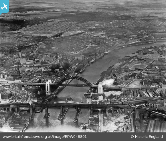
EPW048801 ENGLAND (1935). The High Level Bridge, Newcastle Swing Bridge, Tyne Bridge and the city, Newcastle upon Tyne, 1935. This image has been produced from a print.
© Copyright OpenStreetMap contributors and licensed by the OpenStreetMap Foundation. 2024. Cartography is licensed as CC BY-SA.
Nearby Images (12)
EPW048801

EAW600907

EPW048807

EPW051090

EPW051086

EPW051088

EPW051087

EPW051085

EPW048803

EPW051084

EPW051089

EPW048799

Details
| Title | [EPW048801] The High Level Bridge, Newcastle Swing Bridge, Tyne Bridge and the city, Newcastle upon Tyne, 1935. This image has been produced from a print. |
| Reference | EPW048801 |
| Date | August-1935 |
| Link | |
| Place name | NEWCASTLE UPON TYNE |
| Parish | |
| District | |
| Country | ENGLAND |
| Easting / Northing | 425606, 563988 |
| Longitude / Latitude | -1.5999702432221, 54.969777610856 |
| National Grid Reference | NZ256640 |


