
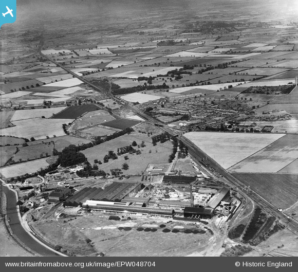
EPW048704 ENGLAND (1935). The Pilkington Brothers Doncaster Glass Works and the village, Kirk Sandall, from the west, 1935
© Copyright OpenStreetMap contributors and licensed by the OpenStreetMap Foundation. 2024. Cartography is licensed as CC BY-SA.
Nearby Images (23)
EPW048704

EPW048709

EPW048712

EPW061652

EPW048711

EPW048702

EPW048710

EPW048706

EPW061662

EPW061654

EPW061659

EPW061657

EPW061664

EPW048713

EPW061660

EPW061663

EPW048705

EPW048708

EPW061661

EPW061653

EPW061658

EPW061656

EPW048707

Details
| Title | [EPW048704] The Pilkington Brothers Doncaster Glass Works and the village, Kirk Sandall, from the west, 1935 |
| Reference | EPW048704 |
| Date | July-1935 |
| Link | |
| Place name | KIRK SANDALL |
| Parish | BARNBY DUN WITH KIRK SANDALL |
| District | |
| Country | ENGLAND |
| Easting / Northing | 460886, 407731 |
| Longitude / Latitude | -1.0806583565731, 53.562416369943 |
| National Grid Reference | SE609077 |
Pins
 jonron |
Saturday 5th of August 2023 03:10:22 AM |


