
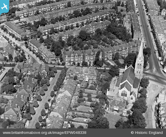
EPW048338 ENGLAND (1935). St James's Church and the surrounding residential area, Muswell Hill, 1935
© Copyright OpenStreetMap contributors and licensed by the OpenStreetMap Foundation. 2024. Cartography is licensed as CC BY-SA.
Nearby Images (19)
EPW048338

EPW048340

EPW048332

EPW048335

EPW048339

EPW048333

EPW048337

EPW048336

EPW048329

EPW048330

EPW048331

EPW048334

EPW038229

EPW038227

EPW038226

EPW038225

EPW038223

EPW038224

EPW038228

Details
| Title | [EPW048338] St James's Church and the surrounding residential area, Muswell Hill, 1935 |
| Reference | EPW048338 |
| Date | July-1935 |
| Link | |
| Place name | MUSWELL HILL |
| Parish | |
| District | |
| Country | ENGLAND |
| Easting / Northing | 528527, 189429 |
| Longitude / Latitude | -0.14451610079801, 51.588562259742 |
| National Grid Reference | TQ285894 |
Pins
Be the first to add a comment to this image!


