
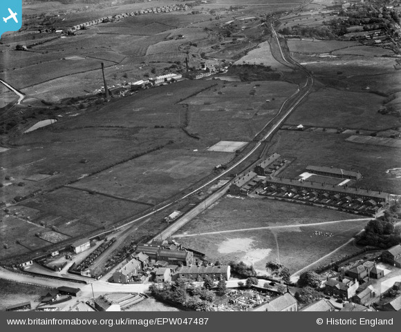
EPW047487 ENGLAND (1935). Royds Street South, the Tottington Branch Railway Line and environs, Tottington, 1935
© Copyright OpenStreetMap contributors and licensed by the OpenStreetMap Foundation. 2024. Cartography is licensed as CC BY-SA.
Nearby Images (5)
EPW047487

EPW047483

EPW047482

EPW047486

EPW047488

Details
| Title | [EPW047487] Royds Street South, the Tottington Branch Railway Line and environs, Tottington, 1935 |
| Reference | EPW047487 |
| Date | May-1935 |
| Link | |
| Place name | TOTTINGTON |
| Parish | |
| District | |
| Country | ENGLAND |
| Easting / Northing | 377898, 413015 |
| Longitude / Latitude | -2.3341217378686, 53.612982377711 |
| National Grid Reference | SD779130 |
Pins
 Triggy |
Wednesday 5th of March 2014 10:33:51 PM | |
In 1884, a French chemist, Hilaire de Charbonnet, Comte de Chardonnay, moved to the area to work on a cellulose-based fabric that became known as "Chardonnay silk". A forerunner of rayon it was an attractive cloth, but like celluloid it was very flammable. Following numerous accidents, it was discontinued. Late 19th/early 20th Century it reverted to the role of traditional Lancashire textile mill. In 1925 the Kirklees Rayon Company began producing viscose continuous filament yarn in the mill. This continued until 1955 when viscose production ceased. Courtaulds took over the Mill in 1962 and converted it into a dye-house, This work continued until 1980. The area is now a housing estate. |
Triggy |
Wednesday 5th of March 2014 11:02:51 PM |
mrlawrence |
Thursday 21st of November 2013 09:34:28 PM |


