
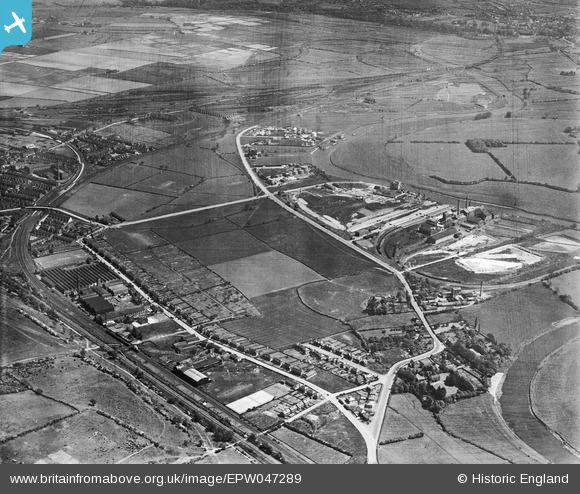
EPW047289 ENGLAND (1935). The Sugar Beet Factory and Concrete Works on the River Trent Navigation, Manor House and Vale Road, Colwick, 1935
© Copyright OpenStreetMap contributors and licensed by the OpenStreetMap Foundation. 2024. Cartography is licensed as CC BY-SA.
Details
| Title | [EPW047289] The Sugar Beet Factory and Concrete Works on the River Trent Navigation, Manor House and Vale Road, Colwick, 1935 |
| Reference | EPW047289 |
| Date | May-1935 |
| Link | |
| Place name | COLWICK |
| Parish | |
| District | |
| Country | ENGLAND |
| Easting / Northing | 461786, 340301 |
| Longitude / Latitude | -1.0801685255705, 52.95620653956 |
| National Grid Reference | SK618403 |
Pins
 RBRT |
Friday 16th of February 2024 06:48:42 PM | |
Brightonboy |
Friday 1st of July 2016 08:46:07 AM | |
Brightonboy |
Friday 1st of July 2016 08:39:04 AM | |
Brightonboy |
Friday 1st of July 2016 08:34:01 AM | |
Brightonboy |
Friday 1st of July 2016 08:33:08 AM | |
Triggy |
Thursday 30th of June 2016 09:57:26 PM | |
Triggy |
Thursday 30th of June 2016 09:57:21 PM | |
Max B |
Wednesday 29th of June 2016 03:04:19 PM | |
Max B |
Wednesday 29th of June 2016 03:02:53 PM |


