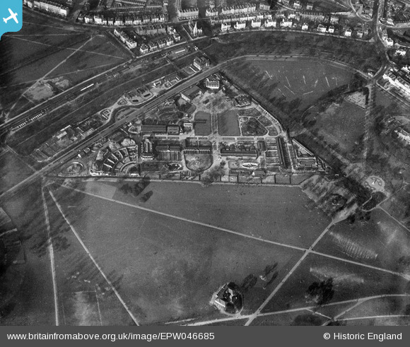
EPW046685 ENGLAND (1935). London Zoo, Regent's Park, 1935
© Copyright OpenStreetMap contributors and licensed by the OpenStreetMap Foundation. 2024. Cartography is licensed as CC BY-SA.
Nearby Images (12)
EPW046685

EAW030112

EAW015832

EPW005914

EAW030113

EAW000547

EAW000546

EPW006154

EPW027042

EAW000543

EPW009092

EAW000544

Details
| Title | [EPW046685] London Zoo, Regent's Park, 1935 |
| Reference | EPW046685 |
| Date | March-1935 |
| Link | |
| Place name | REGENT'S PARK |
| Parish | |
| District | |
| Country | ENGLAND |
| Easting / Northing | 528091, 183336 |
| Longitude / Latitude | -0.15302740887622, 51.533899318434 |
| National Grid Reference | TQ281833 |
Pins
 Kathy Emery |
Saturday 12th of June 2021 09:05:12 PM | |
 Class31 |
Monday 26th of January 2015 12:42:01 PM | |
 Alan McFaden |
Thursday 27th of March 2014 09:00:36 AM | |
JohnO |
Wednesday 5th of February 2014 10:51:55 PM | |
JohnO |
Wednesday 5th of February 2014 10:51:01 PM | |
Alan McFaden |
Friday 12th of July 2013 09:40:22 AM | |
Alan McFaden |
Friday 12th of July 2013 09:39:11 AM | |
Alan McFaden |
Friday 12th of July 2013 09:36:04 AM |