
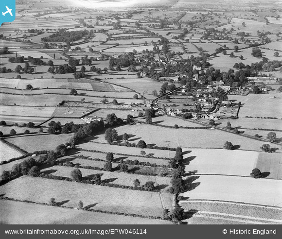
EPW046114 ENGLAND (1934). The village and surrounding countryside, Oxton, from the south, 1934
© Copyright OpenStreetMap contributors and licensed by the OpenStreetMap Foundation. 2024. Cartography is licensed as CC BY-SA.
Nearby Images (4)
EPW046114

EPW046115

EPW046116

EPW046118

Details
| Title | [EPW046114] The village and surrounding countryside, Oxton, from the south, 1934 |
| Reference | EPW046114 |
| Date | September-1934 |
| Link | |
| Place name | OXTON |
| Parish | OXTON |
| District | |
| Country | ENGLAND |
| Easting / Northing | 462684, 350819 |
| Longitude / Latitude | -1.064760343315, 53.050648815144 |
| National Grid Reference | SK627508 |
Pins
 Little Sweetie |
Friday 3rd of April 2020 09:31:29 AM |


