
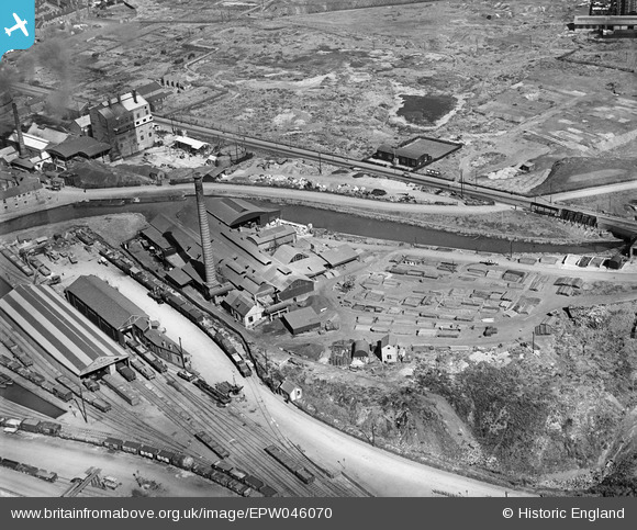
EPW046070 ENGLAND (1934). Rolling Mills and Goods Station at the Oldbury Canal Basin, Oldbury, 1934
© Copyright OpenStreetMap contributors and licensed by the OpenStreetMap Foundation. 2024. Cartography is licensed as CC BY-SA.
Nearby Images (23)
EPW046070

EAW021483

EAW021481

EPW046069

EAW021479

EPW046068

EAW021478

EPW046072

EPW046071

EAW021480

EAW021484

EAW021485

EAW021482

EPW046081

EPW046084

EPW046083

EPW046079

EPW048865

EPW046077

EPW046078

EPW048865A

EPW046085

EPW048860

Details
| Title | [EPW046070] Rolling Mills and Goods Station at the Oldbury Canal Basin, Oldbury, 1934 |
| Reference | EPW046070 |
| Date | September-1934 |
| Link | |
| Place name | OLDBURY |
| Parish | |
| District | |
| Country | ENGLAND |
| Easting / Northing | 398694, 289681 |
| Longitude / Latitude | -2.0192428500619, 52.504658631398 |
| National Grid Reference | SO987897 |
Pins
Be the first to add a comment to this image!


