
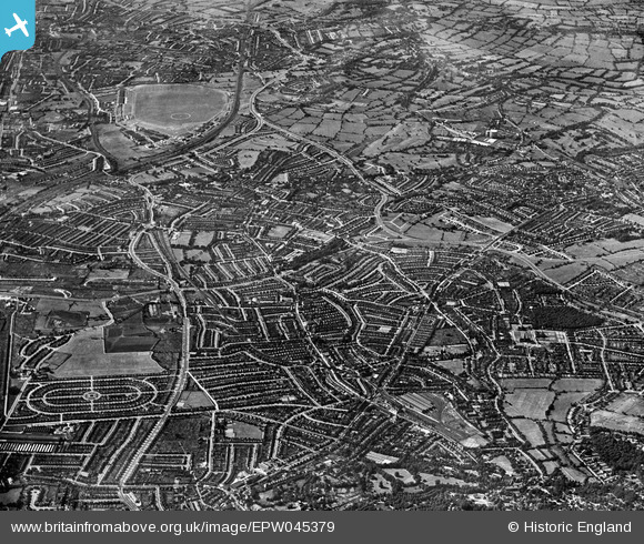
EPW045379 ENGLAND (1934). The view from Child's Hill towards Edgware including RAF Hendon airfield, Hendon, from the south-east, 1934
© Copyright OpenStreetMap contributors and licensed by the OpenStreetMap Foundation. 2024. Cartography is licensed as CC BY-SA.
Nearby Images (14)
EPW045379

EPW021172

EPW005990

EPW028182

EPW028190

EPW000810

EPW008218
 extension from Golders Green to Hendon and Edgware under construction, Child's Hill, 1922. This image has been produced from a copy-negative.")
EPW008214

EPW009094

EPW009095

EPW009535

EPW024243

EPW047879

EPW028180

Details
| Title | [EPW045379] The view from Child's Hill towards Edgware including RAF Hendon airfield, Hendon, from the south-east, 1934 |
| Reference | EPW045379 |
| Date | July-1934 |
| Link | |
| Place name | HENDON |
| Parish | |
| District | |
| Country | ENGLAND |
| Easting / Northing | 525032, 187353 |
| Longitude / Latitude | -0.19568374751501, 51.570689877809 |
| National Grid Reference | TQ250874 |
Pins
 Vectensian |
Sunday 14th of June 2020 12:27:38 PM |


