
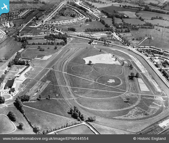
EPW044554 ENGLAND (1934). Northolt Park Race Course, Northolt, 1934
© Copyright OpenStreetMap contributors and licensed by the OpenStreetMap Foundation. 2024. Cartography is licensed as CC BY-SA.
Nearby Images (20)
EPW044554

EPW040900

EPW040902

EPW044273

EPR000013

EPW044270

EPW044271

EPW044950

EPW044944

EPR000621

EPW044268

EPW044266

EPW044949

EPW044269

EPW044272

EPW044946

EPW044945

EPW044947

EPW044267

EPR000014

Details
| Title | [EPW044554] Northolt Park Race Course, Northolt, 1934 |
| Reference | EPW044554 |
| Date | May-1934 |
| Link | |
| Place name | NORTHOLT |
| Parish | |
| District | |
| Country | ENGLAND |
| Easting / Northing | 513350, 184937 |
| Longitude / Latitude | -0.3649662256638, 51.551443244628 |
| National Grid Reference | TQ134849 |
Pins
Be the first to add a comment to this image!


