
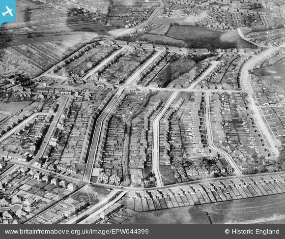
EPW044399 ENGLAND (1934). Housing development between Oaklands Avenue and Halfway Street, Blackfen, 1934
© Copyright OpenStreetMap contributors and licensed by the OpenStreetMap Foundation. 2024. Cartography is licensed as CC BY-SA.
Nearby Images (4)
EPW044399

EPW044398

EPW044280

EPW044279

Details
| Title | [EPW044399] Housing development between Oaklands Avenue and Halfway Street, Blackfen, 1934 |
| Reference | EPW044399 |
| Date | May-1934 |
| Link | |
| Place name | BLACKFEN |
| Parish | |
| District | |
| Country | ENGLAND |
| Easting / Northing | 545471, 173445 |
| Longitude / Latitude | 0.093333118939431, 51.440802541457 |
| National Grid Reference | TQ455734 |
Pins
 Tom Burnham |
Thursday 4th of June 2015 10:43:57 PM |


