
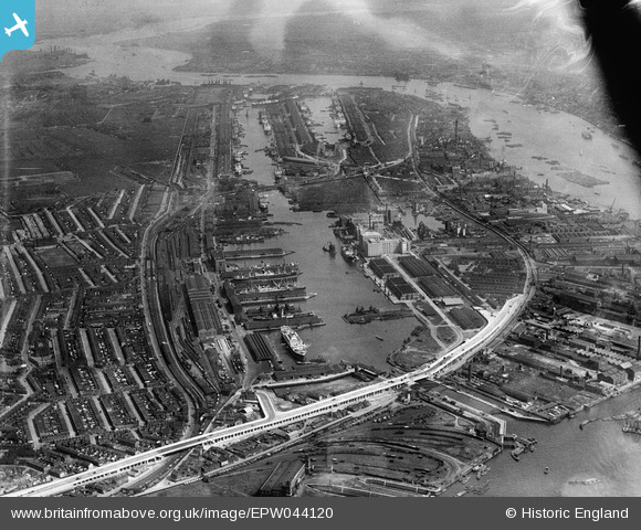
EPW044120 ENGLAND (1934). The Royal Group of Docks and the River Thames, East Ham, from the west, 1934
© Copyright OpenStreetMap contributors and licensed by the OpenStreetMap Foundation. 2024. Cartography is licensed as CC BY-SA.
Nearby Images (20)
EPW044120

EPW046150

EPW008889

EAW016655

EAW008826

EAW008819

EPW032933

EAW000053

EPR000001

EAW016656

EAW035765

EAW008823

EAW008816

EAW008820

EPW008886

EAW008822

EPW032934

EPW055308

EAW035768

EPW044114

Details
| Title | [EPW044120] The Royal Group of Docks and the River Thames, East Ham, from the west, 1934 |
| Reference | EPW044120 |
| Date | May-1934 |
| Link | |
| Place name | EAST HAM |
| Parish | |
| District | |
| Country | ENGLAND |
| Easting / Northing | 540553, 180586 |
| Longitude / Latitude | 0.025452389098988, 51.506220118438 |
| National Grid Reference | TQ406806 |


