
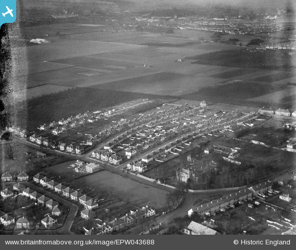
EPW043688 ENGLAND (1934). Meadow Waye and environs, Heston, from the south-east, 1934. This image has been produced from a damaged negative.
© Copyright OpenStreetMap contributors and licensed by the OpenStreetMap Foundation. 2024. Cartography is licensed as CC BY-SA.
Nearby Images (14)
EPW043688

EPW043689

EPW043709

EPW043707

EPW043706

EPW043708

EPW057931

EPW043705

EPW043693

EPW043710

EPW043704

EPW043690

EPW043692

EPW043691

Details
| Title | [EPW043688] Meadow Waye and environs, Heston, from the south-east, 1934. This image has been produced from a damaged negative. |
| Reference | EPW043688 |
| Date | January-1934 |
| Link | |
| Place name | HESTON |
| Parish | |
| District | |
| Country | ENGLAND |
| Easting / Northing | 512363, 177314 |
| Longitude / Latitude | -0.3816280941958, 51.48311844897 |
| National Grid Reference | TQ124773 |
Pins
 Isleworth1961 |
Sunday 26th of June 2016 04:57:14 PM |


