
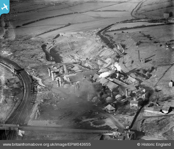
EPW043655 ENGLAND (1933). Knutton Tileries, Newcastle-under-Lyme, 1933
© Copyright OpenStreetMap contributors and licensed by the OpenStreetMap Foundation. 2024. Cartography is licensed as CC BY-SA.
Nearby Images (12)
EPW043655

EPW038478

EPW043652

EPW038476

EPW043654

EPW027807

EPW038480

EPW038481

EPW027808

EPW038477

EPW043656

EPW038479

Details
| Title | [EPW043655] Knutton Tileries, Newcastle-under-Lyme, 1933 |
| Reference | EPW043655 |
| Date | November-1933 |
| Link | |
| Place name | NEWCASTLE-UNDER-LYME |
| Parish | SILVERDALE |
| District | |
| Country | ENGLAND |
| Easting / Northing | 382955, 346693 |
| Longitude / Latitude | -2.2541088611334, 53.016959722076 |
| National Grid Reference | SJ830467 |
Pins
Be the first to add a comment to this image!


