
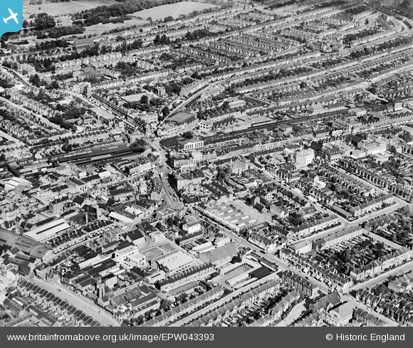
EPW043393 ENGLAND (1933). The town centre, Ilford, 1933
© Copyright OpenStreetMap contributors and licensed by the OpenStreetMap Foundation. 2024. Cartography is licensed as CC BY-SA.
Nearby Images (7)
EPW043393

EPW043394

EPW024245

EPW043396

EPW024242

EPW043397

EPW043395

Details
| Title | [EPW043393] The town centre, Ilford, 1933 |
| Reference | EPW043393 |
| Date | October-1933 |
| Link | |
| Place name | ILFORD |
| Parish | |
| District | |
| Country | ENGLAND |
| Easting / Northing | 543657, 186413 |
| Longitude / Latitude | 0.072529295552417, 51.557804254848 |
| National Grid Reference | TQ437864 |


