
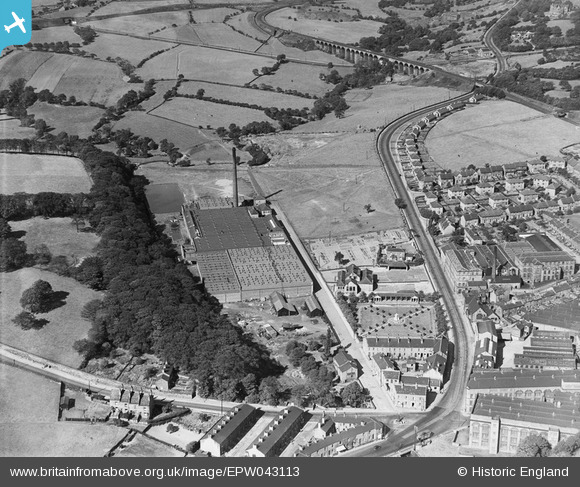
EPW043113 ENGLAND (1933). Victoria Mills J.F. Firth and Son, Bailiff Bridge, 1933
© Copyright OpenStreetMap contributors and licensed by the OpenStreetMap Foundation. 2024. Cartography is licensed as CC BY-SA.
Nearby Images (20)
EPW043113

EPW043114

EPW043116

EPW043112

EPW043117

EAW030666

EAW030664

EAW030667

EAW030671

EAW030663

EAW030665

EAW030669

EAW030670

EPW043115

EAW030672

EAW030668

EPW043107

EPW043108

EPW043109

EPW043110

Details
| Title | [EPW043113] Victoria Mills J.F. Firth and Son, Bailiff Bridge, 1933 |
| Reference | EPW043113 |
| Date | September-1933 |
| Link | |
| Place name | BAILIFF BRIDGE |
| Parish | |
| District | |
| Country | ENGLAND |
| Easting / Northing | 414700, 425400 |
| Longitude / Latitude | -1.7771885276654, 53.724572930984 |
| National Grid Reference | SE147254 |
Pins
Be the first to add a comment to this image!


