
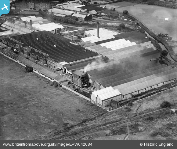
EPW042084 ENGLAND (1933). The Gothic Gas Meter and Stove Works, Edmonton, 1933
© Copyright OpenStreetMap contributors and licensed by the OpenStreetMap Foundation. 2024. Cartography is licensed as CC BY-SA.
Nearby Images (30)
EPW042084

EPW032036

EPW044754

EPW042083

EPW044753

EPW032044

EPW032764

EPW049530

EPW032760

EPW032761

EPW032763

EPW032758

EPW032039

EPW044755

EPW032757

EPW032762

EPW032759

EPW032043

EPW032042

EPW032037

EPW044759

EPW032038

EPW044756

EPW044760

EPW056394

EPW044761

EPW044757

EPW044758

EPW044750

EPW044751

Details
| Title | [EPW042084] The Gothic Gas Meter and Stove Works, Edmonton, 1933 |
| Reference | EPW042084 |
| Date | June-1933 |
| Link | |
| Place name | EDMONTON |
| Parish | |
| District | |
| Country | ENGLAND |
| Easting / Northing | 535354, 191738 |
| Longitude / Latitude | -0.045127018790593, 51.607714669065 |
| National Grid Reference | TQ354917 |
Pins
Be the first to add a comment to this image!


