
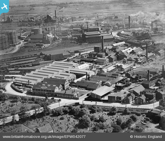
EPW042077 ENGLAND (1933). Sculcoates Lane, the Greenland Paint & Colour Works and adjacent factories, Sculcoates, 1933
© Copyright OpenStreetMap contributors and licensed by the OpenStreetMap Foundation. 2024. Cartography is licensed as CC BY-SA.
Nearby Images (15)
EPW042077

EPW042076

EPW042075

EPW042078

EPW036532

EPW042072

EPW042073

EPW042074

EPW036525

EPW036510

EAW030288

EPW006338

EPW036522

EPW036508

EPW047931

Details
| Title | [EPW042077] Sculcoates Lane, the Greenland Paint & Colour Works and adjacent factories, Sculcoates, 1933 |
| Reference | EPW042077 |
| Date | June-1933 |
| Link | |
| Place name | SCULCOATES |
| Parish | |
| District | |
| Country | ENGLAND |
| Easting / Northing | 509670, 430848 |
| Longitude / Latitude | -0.33615027745573, 53.762205907882 |
| National Grid Reference | TA097308 |
Pins
 Dylan Moore |
Monday 6th of May 2013 08:29:25 PM |


