
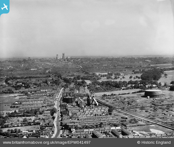
EPW041497 ENGLAND (1933). The Bracebridge Gasworks looking towards Lincoln Cathedral, Lincoln, from the south, 1933
© Copyright OpenStreetMap contributors and licensed by the OpenStreetMap Foundation. 2024. Cartography is licensed as CC BY-SA.
Nearby Images (25)
EPW041497

EAW003306

EAW003308

EAW003307

EAW003310

EPW041500

EPW041496

EAW003309

EPW041499

EPW041498

EAW003302

EAW003305

EAW003301

EAW003311

EAW003303

EAW002778

EAW002776

EAW002780

EAW003304

EAW002779

EAW002777

EAW002775

EPW041495

EPW041501

EAW003300

Details
| Title | [EPW041497] The Bracebridge Gasworks looking towards Lincoln Cathedral, Lincoln, from the south, 1933 |
| Reference | EPW041497 |
| Date | June-1933 |
| Link | |
| Place name | LINCOLN |
| Parish | |
| District | |
| Country | ENGLAND |
| Easting / Northing | 497006, 368699 |
| Longitude / Latitude | -0.54741716763693, 53.206212748505 |
| National Grid Reference | SK970687 |
Pins
 John Herridge |
Tuesday 27th of April 2021 12:11:31 PM |


