
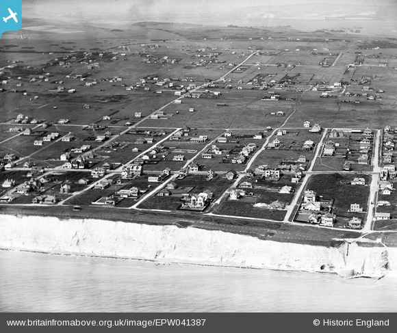
EPW041387 ENGLAND (1933). Horsham Avenue and environs, Peacehaven, from the south, 1933
© Copyright OpenStreetMap contributors and licensed by the OpenStreetMap Foundation. 2024. Cartography is licensed as CC BY-SA.
Nearby Images (4)
EPW041387

EPW041394

EPW042946

EPW054055

Details
| Title | [EPW041387] Horsham Avenue and environs, Peacehaven, from the south, 1933 |
| Reference | EPW041387 |
| Date | May-1933 |
| Link | |
| Place name | PEACEHAVEN |
| Parish | PEACEHAVEN |
| District | |
| Country | ENGLAND |
| Easting / Northing | 541020, 100757 |
| Longitude / Latitude | 0.00089966646054896, 50.788642595353 |
| National Grid Reference | TQ410008 |
Pins
 vandyke4ad |
Wednesday 22nd of October 2014 11:50:20 AM | |
vandyke4ad |
Wednesday 22nd of October 2014 11:49:01 AM | |
classicforever |
Friday 6th of September 2013 10:32:04 PM | |
This is Roderick Avenue, which then, ran right up to "Peacehaven Annexe" at Telscombe Road. Barclays Bank is on the NE corner where it crosses the South Coast Road. |
vandyke4ad |
Wednesday 22nd of October 2014 11:46:13 AM |
classicforever |
Friday 6th of September 2013 10:31:00 PM | |
This is Edith Avenue, with the "Central Club" on the NW corner where it crosses the South Coast Road. |
vandyke4ad |
Wednesday 22nd of October 2014 11:47:40 AM |
classicforever |
Friday 6th of September 2013 10:30:16 PM | |
This is Horsham, not Bramber, Avenue |
vandyke4ad |
Wednesday 22nd of October 2014 11:43:38 AM |
classicforever |
Friday 6th of September 2013 10:29:01 PM | |
This is Dorothy Avenue, not Steyning. |
vandyke4ad |
Wednesday 22nd of October 2014 11:42:17 AM |
User Comment Contributions
Peacehaven - a blot on the landscape ! |
Rob |
Tuesday 18th of November 2014 10:14:01 PM |


