
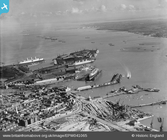
EPW041065 ENGLAND (1933). Ocean Dock, the RMS Mauretania in the floating dry dock and environs, Southampton, from the north-west, 1933
© Copyright OpenStreetMap contributors and licensed by the OpenStreetMap Foundation. 2024. Cartography is licensed as CC BY-SA.
Nearby Images (15)
EPW041065

EPW032342

EPW042962

EPW041066

EPW041064

EPW032341

EAW001347

EPW009072

EAW020647
 Marine Airport and the surrounding docks, Southampton, 1948")
EPW020447

EAW020645
 Marine Airport and the surrounding docks, Southampton, 1948")
EPW041067

EAW008802

EAW189228

EAW020646
 Marine Airport and the surrounding docks, Southampton, 1948")
Details
| Title | [EPW041065] Ocean Dock, the RMS Mauretania in the floating dry dock and environs, Southampton, from the north-west, 1933 |
| Reference | EPW041065 |
| Date | April-1933 |
| Link | |
| Place name | SOUTHAMPTON |
| Parish | |
| District | |
| Country | ENGLAND |
| Easting / Northing | 441976, 110899 |
| Longitude / Latitude | -1.4030726547628, 50.895490654541 |
| National Grid Reference | SU420109 |
Pins
 wervano |
Sunday 26th of June 2022 01:11:30 PM | |
wervano |
Sunday 26th of June 2022 01:11:03 PM | |
wervano |
Sunday 26th of June 2022 01:09:36 PM | |
John Wass |
Wednesday 30th of December 2015 08:45:15 PM | |
Graham Yaxley |
Sunday 4th of January 2015 11:42:50 PM | |
Graham Yaxley |
Sunday 4th of January 2015 11:41:03 PM |


