
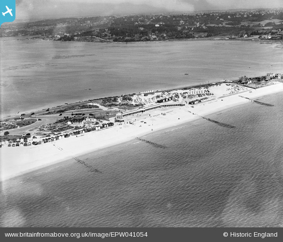
EPW041054 ENGLAND (1933). The Pavilion and Recreation Ground, Sandbanks, 1933
© Copyright OpenStreetMap contributors and licensed by the OpenStreetMap Foundation. 2024. Cartography is licensed as CC BY-SA.
Nearby Images (10)
EPW041054

EPW061369

EPW061365

EPW061368

EPW061370

EPW061366

EPW061367

EAW010739

EPW037419

EPW061354

Details
| Title | [EPW041054] The Pavilion and Recreation Ground, Sandbanks, 1933 |
| Reference | EPW041054 |
| Date | April-1933 |
| Link | |
| Place name | SANDBANKS |
| Parish | |
| District | |
| Country | ENGLAND |
| Easting / Northing | 404515, 87744 |
| Longitude / Latitude | -1.9360764505735, 50.688752429434 |
| National Grid Reference | SZ045877 |
Pins
Be the first to add a comment to this image!
User Comment Contributions
 Looking east 8/3/2014 |
 Class31 |
Monday 10th of March 2014 03:46:02 PM |


