
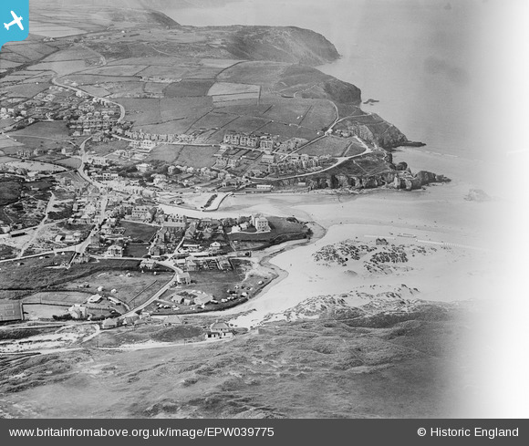
EPW039775 ENGLAND (1932). Perran Beach, the town and adjacent coastline, Perranporth, 1932. This image has been affected by flare.
© Copyright OpenStreetMap contributors and licensed by the OpenStreetMap Foundation. 2024. Cartography is licensed as CC BY-SA.
Nearby Images (5)
EPW039775

EPW007156A

EPW039772

EPW039776

EPW039773

Details
| Title | [EPW039775] Perran Beach, the town and adjacent coastline, Perranporth, 1932. This image has been affected by flare. |
| Reference | EPW039775 |
| Date | August-1932 |
| Link | |
| Place name | PERRANPORTH |
| Parish | PERRANZABULOE |
| District | |
| Country | ENGLAND |
| Easting / Northing | 175695, 54425 |
| Longitude / Latitude | -5.1531208473812, 50.346339477586 |
| National Grid Reference | SW757544 |
Pins
Be the first to add a comment to this image!


