
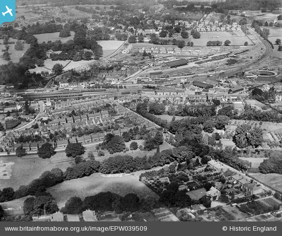
EPW039509 ENGLAND (1932). Housing off Depot Road, Horsham Railway Station and the J. & S. Agate Ltd. Saw Mills, Horsham, 1932
© Copyright OpenStreetMap contributors and licensed by the OpenStreetMap Foundation. 2024. Cartography is licensed as CC BY-SA.
Details
| Title | [EPW039509] Housing off Depot Road, Horsham Railway Station and the J. & S. Agate Ltd. Saw Mills, Horsham, 1932 |
| Reference | EPW039509 |
| Date | August-1932 |
| Link | |
| Place name | HORSHAM |
| Parish | |
| District | |
| Country | ENGLAND |
| Easting / Northing | 518057, 131005 |
| Longitude / Latitude | -0.31495512751925, 51.065690133626 |
| National Grid Reference | TQ181310 |
Pins
 Dan Gregory |
Thursday 7th of January 2021 05:28:39 PM | |
Dan Gregory |
Thursday 7th of January 2021 05:27:18 PM | |
Tony |
Wednesday 18th of September 2019 09:52:30 AM | |
Dan Gregory |
Monday 2nd of June 2014 07:21:01 PM | |
Dan Gregory |
Monday 2nd of June 2014 07:18:49 PM | |
Dan Gregory |
Monday 2nd of June 2014 07:16:45 PM | |
Dan Gregory |
Monday 2nd of June 2014 07:15:25 PM | |
Dan Gregory |
Monday 2nd of June 2014 07:14:24 PM | |
Dan Gregory |
Monday 2nd of June 2014 07:12:58 PM | |
Dan Gregory |
Monday 2nd of June 2014 07:12:10 PM | |
Dan Gregory |
Monday 2nd of June 2014 07:08:59 PM | |
JerryE |
Saturday 19th of October 2013 08:53:21 PM | |
JerryE |
Saturday 19th of October 2013 08:48:10 PM |


