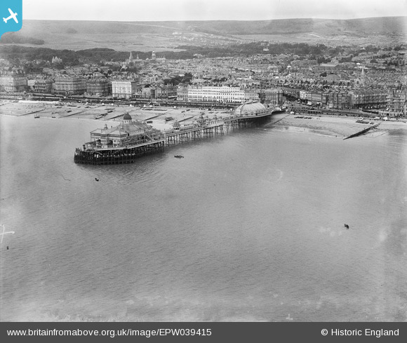
EPW039415 ENGLAND (1932). The Pier, Eastbourne, from the east, 1932
© Copyright OpenStreetMap contributors and licensed by the OpenStreetMap Foundation. 2024. Cartography is licensed as CC BY-SA.
Nearby Images (6)
EPW039415

EPW000746

EPW000067

EPW035324

EAW022970

EAW006146

Details
| Title | [EPW039415] The Pier, Eastbourne, from the east, 1932 |
| Reference | EPW039415 |
| Date | August-1932 |
| Link | |
| Place name | EASTBOURNE |
| Parish | |
| District | |
| Country | ENGLAND |
| Easting / Northing | 562082, 98792 |
| Longitude / Latitude | 0.29863706993432, 50.765477898004 |
| National Grid Reference | TV621988 |
Pins
 Alan McFaden |
Monday 22nd of April 2013 04:23:26 PM | |
Alan McFaden |
Monday 22nd of April 2013 04:21:22 PM | |
Alan McFaden |
Monday 22nd of April 2013 04:19:23 PM | |
Alan McFaden |
Monday 22nd of April 2013 04:16:49 PM | |
Alan McFaden |
Monday 22nd of April 2013 04:15:54 PM | |
Alan McFaden |
Monday 22nd of April 2013 04:15:13 PM | |
Alan McFaden |
Monday 22nd of April 2013 04:14:12 PM | |
Alan McFaden |
Monday 22nd of April 2013 04:13:30 PM | |
Alan McFaden |
Monday 22nd of April 2013 04:12:27 PM | |
Alan McFaden |
Monday 22nd of April 2013 04:09:29 PM |