
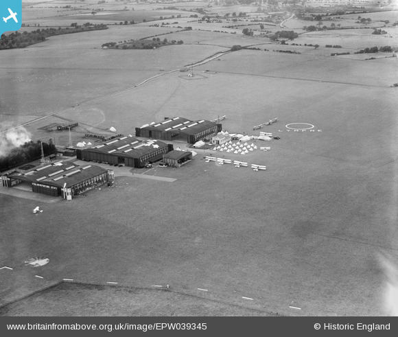
EPW039345 ENGLAND (1932). Lympne Airport, Lympne, 1932
© Copyright OpenStreetMap contributors and licensed by the OpenStreetMap Foundation. 2024. Cartography is licensed as CC BY-SA.
Nearby Images (7)
EPW039345

EPW026077

EPW035406

EPW026078

EPW007030

EAW013660
 at Lympne Aerodrome, Lympne, 1948")
EAW013661
 at Lympne Aerodrome, Lympne, from the south, 1948")
Details
| Title | [EPW039345] Lympne Airport, Lympne, 1932 |
| Reference | EPW039345 |
| Date | July-1932 |
| Link | |
| Place name | LYMPNE |
| Parish | LYMPNE |
| District | |
| Country | ENGLAND |
| Easting / Northing | 611237, 135367 |
| Longitude / Latitude | 1.0160277749163, 51.078148181488 |
| National Grid Reference | TR112354 |
Pins
 Pembroke |
Saturday 23rd of December 2017 12:47:17 PM |
User Comment Contributions
The aerial shot appears to show an annual camp by one of the RAF's auxiliary squadrons. No. 601 Squadron was here in August 1931 and again in 1933. No. 606 Squadron was here in July 1934, followed by 601 Squadron (City of London) again. More on Lympne here: en.wikipedia.org/wiki/RAF_Lympne |
MB |
Monday 28th of October 2013 09:16:00 PM |


