
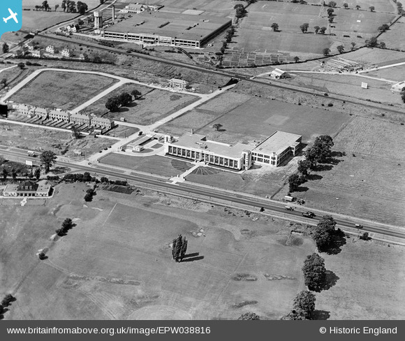
EPW038816 ENGLAND (1932). The Hoover Factory, Perivale, 1932
© Copyright OpenStreetMap contributors and licensed by the OpenStreetMap Foundation. 2024. Cartography is licensed as CC BY-SA.
Nearby Images (24)
EPW038816

EPW038815

EPW039558

EPW038721

EPW039562

EPW039555

EPW039554

EPW039556

EPW038719

EPW039559

EPW039560

EPW039561

EPW039563

EPW039557

EPW039556A

EPW040869

EPW040870

EPW043714

EPW040868

EPW035540

EPW043712

EPW043715

EPW038720

EPW053243

Details
| Title | [EPW038816] The Hoover Factory, Perivale, 1932 |
| Reference | EPW038816 |
| Date | June-1932 |
| Link | |
| Place name | PERIVALE |
| Parish | |
| District | |
| Country | ENGLAND |
| Easting / Northing | 516671, 182957 |
| Longitude / Latitude | -0.31774042535845, 51.532968789598 |
| National Grid Reference | TQ167830 |
Pins
Be the first to add a comment to this image!


