
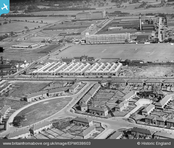
EPW038603 ENGLAND (1932). Bracken Road, Fort Dunlop and environs, Tyburn, 1932
© Copyright OpenStreetMap contributors and licensed by the OpenStreetMap Foundation. 2024. Cartography is licensed as CC BY-SA.
Nearby Images (9)
EPW038603

EPW059295

EPW059296

EPW059294

EPW059299

EPW059297

EPW059298

EPW026933

EPW026941

Details
| Title | [EPW038603] Bracken Road, Fort Dunlop and environs, Tyburn, 1932 |
| Reference | EPW038603 |
| Date | June-1932 |
| Link | |
| Place name | TYBURN |
| Parish | |
| District | |
| Country | ENGLAND |
| Easting / Northing | 412165, 290798 |
| Longitude / Latitude | -1.8207182077932, 52.514567315361 |
| National Grid Reference | SP122908 |
Pins
 frothy |
Monday 12th of August 2019 01:14:23 PM | |
frothy |
Monday 12th of August 2019 01:08:21 PM | |
frothy |
Tuesday 4th of July 2017 07:43:15 AM | |
frothy |
Tuesday 4th of July 2017 07:36:32 AM | |
frothy |
Wednesday 1st of March 2017 04:51:22 PM | |
frothy |
Wednesday 1st of March 2017 04:50:26 PM | |
frothy |
Wednesday 1st of March 2017 04:49:42 PM | |
frothy |
Wednesday 1st of March 2017 04:48:48 PM | |
frothy |
Wednesday 1st of March 2017 04:47:38 PM | |
 Martin |
Monday 30th of December 2013 07:02:25 PM | |
Martin |
Monday 30th of December 2013 07:01:42 PM | |
frothy |
Wednesday 28th of August 2013 05:27:59 PM | |
frothy |
Wednesday 28th of August 2013 05:27:30 PM | |
frothy |
Wednesday 28th of August 2013 05:26:33 PM | |
MB |
Tuesday 5th of February 2013 10:31:42 AM | |
MB |
Tuesday 5th of February 2013 10:31:14 AM | |
MB |
Tuesday 5th of February 2013 10:30:17 AM | |
MB |
Tuesday 5th of February 2013 10:29:57 AM |


