
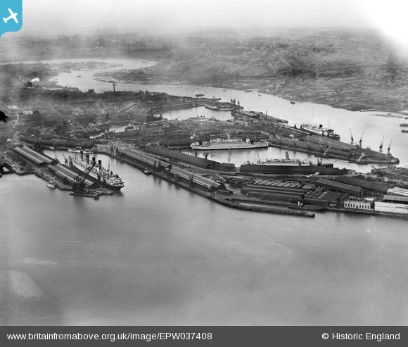
EPW037408 ENGLAND (1932). Ocean liners moored in the Ocean Dock and the Empress Dock, Southampton, from the south-west, 1932
© Copyright OpenStreetMap contributors and licensed by the OpenStreetMap Foundation. 2024. Cartography is licensed as CC BY-SA.
Nearby Images (22)
EPW037408

EPW032343

EAW033413

EPW009070

EPW037407

EPW041070

EAW001349

EAW001348

EAW046509

EAW001346

EAW051594

EAW035248

EAW008809

EPW000238

EPW009065

EAW051593

EAW035250

EPW032346

EAW001373
 in Ocean Dock, Southampton, 1946")
EAW033407

EAW033411

EAW008810

Details
| Title | [EPW037408] Ocean liners moored in the Ocean Dock and the Empress Dock, Southampton, from the south-west, 1932 |
| Reference | EPW037408 |
| Date | April-1932 |
| Link | |
| Place name | SOUTHAMPTON |
| Parish | |
| District | |
| Country | ENGLAND |
| Easting / Northing | 442263, 110073 |
| Longitude / Latitude | -1.3990871491083, 50.88804154074 |
| National Grid Reference | SU423101 |
Pins
 Isleworth1961 |
Saturday 25th of May 2013 12:41:51 AM |


