
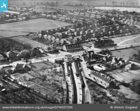
EPW037296 ENGLAND (1932). Hounslow West Station, Bath Road and environs, Hounslow West, 1932. This image has been produced from a copy-negative.
© Copyright OpenStreetMap contributors and licensed by the OpenStreetMap Foundation. 2024. Cartography is licensed as CC BY-SA.
Nearby Images (17)
EPW037296

EPW037518

EPW037517

EPW037334

EPW037519

EPW016528

EPW016527

EPW016529

EPW037332

EPW017168

EPW033774

EPW017162

EPW035079

EPW037294

EPW033773

EPW033772

EPW035093

Details
| Title | [EPW037296] Hounslow West Station, Bath Road and environs, Hounslow West, 1932. This image has been produced from a copy-negative. |
| Reference | EPW037296 |
| Date | March-1932 |
| Link | |
| Place name | HOUNSLOW WEST |
| Parish | |
| District | |
| Country | ENGLAND |
| Easting / Northing | 512166, 176112 |
| Longitude / Latitude | -0.38484604508208, 51.472352826088 |
| National Grid Reference | TQ122761 |
Pins
Be the first to add a comment to this image!


