
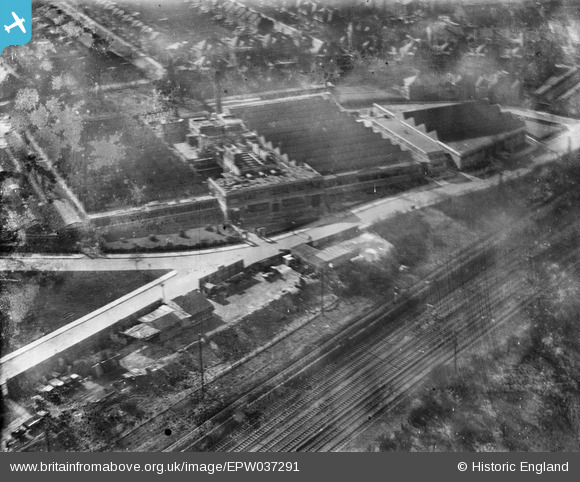
EPW037291 ENGLAND (1932). Wall's Ice Cream and Sausage Factory, Acton, 1932
© Copyright OpenStreetMap contributors and licensed by the OpenStreetMap Foundation. 2024. Cartography is licensed as CC BY-SA.
Nearby Images (31)
EPW037291

EAW005401

EAW006446

EAW005395

EAW005400

EAW005406

EAW005396

EAW006448

EAW006454

EAW006452

EAW005405

EAW005397

EPW037284

EAW006449

EPW037285

EAW005399

EAW006455

EAW006453

EPW037289

EPW037290

EAW006447

EAW005398

EAW006451

EAW005403

EPW037287

EAW005402

EPW037286

EAW006450

EPW037288

EAW005404

EPW058338

Details
| Title | [EPW037291] Wall's Ice Cream and Sausage Factory, Acton, 1932 |
| Reference | EPW037291 |
| Date | March-1932 |
| Link | |
| Place name | ACTON |
| Parish | |
| District | |
| Country | ENGLAND |
| Easting / Northing | 520565, 181252 |
| Longitude / Latitude | -0.2622044752213, 51.516825404182 |
| National Grid Reference | TQ206813 |
Pins
Be the first to add a comment to this image!


