
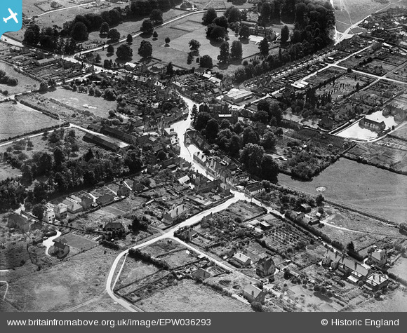
EPW036293 ENGLAND (1931). The town centre, Chalfont St Peter, 1931
© Copyright OpenStreetMap contributors and licensed by the OpenStreetMap Foundation. 2024. Cartography is licensed as CC BY-SA.
Nearby Images (4)
EPW036293

EPW036296

EPW036295

EPW036298

Details
| Title | [EPW036293] The town centre, Chalfont St Peter, 1931 |
| Reference | EPW036293 |
| Date | August-1931 |
| Link | |
| Place name | CHALFONT ST PETER |
| Parish | CHALFONT ST. PETER |
| District | |
| Country | ENGLAND |
| Easting / Northing | 500105, 190923 |
| Longitude / Latitude | -0.55424414952847, 51.607760669607 |
| National Grid Reference | TQ001909 |
Pins
 |
 jkm |
Wednesday 21st of April 2021 05:58:51 PM |
 |
jkm |
Wednesday 21st of April 2021 05:55:52 PM |
jkm |
Wednesday 21st of April 2021 05:35:27 PM | |
jkm |
Wednesday 21st of April 2021 05:34:12 PM | |
jkm |
Wednesday 21st of April 2021 05:33:27 PM | |
jkm |
Wednesday 21st of April 2021 05:17:54 PM | |
jkm |
Wednesday 21st of April 2021 05:15:29 PM | |
jkm |
Wednesday 21st of April 2021 05:14:25 PM | |
jkm |
Wednesday 21st of April 2021 05:09:04 PM | |
jkm |
Wednesday 21st of April 2021 05:05:18 PM | |
Lynda Tubbs |
Tuesday 25th of February 2014 01:06:55 PM | |
Lynda Tubbs |
Wednesday 5th of February 2014 11:49:55 AM |


User Comment Contributions
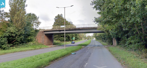
 An image showing a First World War munitions factory which is still standing, although well-concealed from the road. When was it active and what was being produced? |
Lynda Tubbs |
Tuesday 25th of February 2014 01:10:52 PM |


