
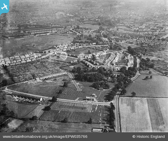
EPW035766 ENGLAND (1931). Wallace Road, housing surrounding Radford Road and environs, Radford, 1931
© Copyright OpenStreetMap contributors and licensed by the OpenStreetMap Foundation. 2024. Cartography is licensed as CC BY-SA.
Nearby Images (3)
EPW035766

EPW035767

EPW035769

Details
| Title | [EPW035766] Wallace Road, housing surrounding Radford Road and environs, Radford, 1931 |
| Reference | EPW035766 |
| Date | 1-July-1931 |
| Link | |
| Place name | RADFORD |
| Parish | |
| District | |
| Country | ENGLAND |
| Easting / Northing | 432351, 281269 |
| Longitude / Latitude | -1.5241594608256, 52.428070342847 |
| National Grid Reference | SP324813 |
Pins
 |
 Jonah66 |
Sunday 3rd of January 2021 01:34:09 PM |
John |
Saturday 18th of May 2019 03:12:54 PM | |
Retro |
Wednesday 17th of February 2016 06:11:27 PM | |
CovRes |
Monday 4th of May 2015 12:21:08 AM | |
 offshoredaze |
Thursday 5th of December 2013 09:19:46 PM | |
SteveBo |
Tuesday 19th of March 2013 07:57:23 PM | |
 Class31 |
Tuesday 12th of March 2013 08:42:55 AM | |
Class31 |
Tuesday 12th of March 2013 08:42:19 AM | |
Class31 |
Tuesday 12th of March 2013 08:41:48 AM | |
Class31 |
Tuesday 12th of March 2013 08:40:38 AM | |
Class31 |
Tuesday 12th of March 2013 08:40:00 AM | |
Class31 |
Tuesday 12th of March 2013 08:39:06 AM | |
SteveBo |
Monday 11th of March 2013 08:19:18 PM | |
SteveBo |
Monday 11th of March 2013 08:17:24 PM | |
SteveBo |
Monday 11th of March 2013 08:16:45 PM | |
SteveBo |
Monday 11th of March 2013 08:16:15 PM | |
SteveBo |
Monday 11th of March 2013 08:15:37 PM |
User Comment Contributions
View looking south east. |
Class31 |
Tuesday 12th of March 2013 08:43:52 AM |


