
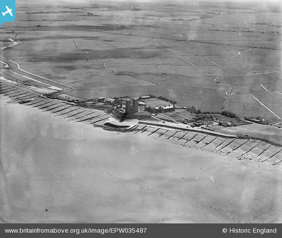
EPW035487 ENGLAND (1931). The ruins of St Mary's Church and environs, Reculver, 1931
© Copyright OpenStreetMap contributors and licensed by the OpenStreetMap Foundation. 2024. Cartography is licensed as CC BY-SA.
Nearby Images (6)
EPW035487

EPW035490

EPW000531

EPW035489

EPW009220

EPW035488

Details
| Title | [EPW035487] The ruins of St Mary's Church and environs, Reculver, 1931 |
| Reference | EPW035487 |
| Date | May-1931 |
| Link | |
| Place name | RECULVER |
| Parish | |
| District | |
| Country | ENGLAND |
| Easting / Northing | 622736, 169344 |
| Longitude / Latitude | 1.2010613764063, 51.378878835498 |
| National Grid Reference | TR227693 |
Pins
Be the first to add a comment to this image!


