
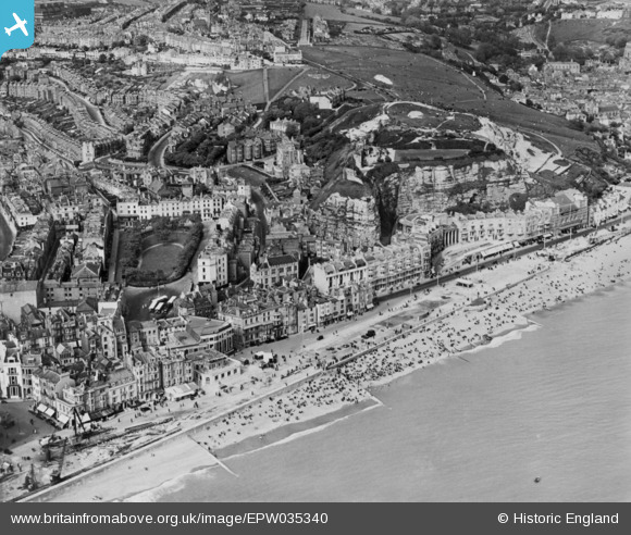
EPW035340 ENGLAND (1931). Wellington Square and Castle Hill, Hastings, 1931. This image has been produced from a copy-negative.
© Copyright OpenStreetMap contributors and licensed by the OpenStreetMap Foundation. 2024. Cartography is licensed as CC BY-SA.
Nearby Images (15)
EPW035340

EPW026212

EAW006150

EPW000758

EPW000111

EAW006149

EPW000105

EPW026189

EAW006151

EAW006148

EPW026205

EPW039367

EPW039365

EPW026201

EPW026210

Details
| Title | [EPW035340] Wellington Square and Castle Hill, Hastings, 1931. This image has been produced from a copy-negative. |
| Reference | EPW035340 |
| Date | 25-May-1931 |
| Link | |
| Place name | HASTINGS |
| Parish | |
| District | |
| Country | ENGLAND |
| Easting / Northing | 581930, 109422 |
| Longitude / Latitude | 0.58510112294639, 50.855098127712 |
| National Grid Reference | TQ819094 |


