
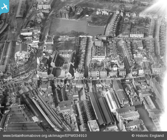
EPW034910 ENGLAND (1931). The Convent and School of the Sacred Heart, the West London Hospital and environs, Hammersmith, 1931
© Copyright OpenStreetMap contributors and licensed by the OpenStreetMap Foundation. 2024. Cartography is licensed as CC BY-SA.
Nearby Images (13)
EPW034910

EPW034904

EPW034909

EPW034905

EPW034906

EPW034907

EPW034911

EPW034903

EPW034908

EPW025119

EPR000469

EPW057072

EPW045415

Details
| Title | [EPW034910] The Convent and School of the Sacred Heart, the West London Hospital and environs, Hammersmith, 1931 |
| Reference | EPW034910 |
| Date | March-1931 |
| Link | |
| Place name | HAMMERSMITH |
| Parish | |
| District | |
| Country | ENGLAND |
| Easting / Northing | 523498, 178673 |
| Longitude / Latitude | -0.22085382354251, 51.493011232241 |
| National Grid Reference | TQ235787 |


