
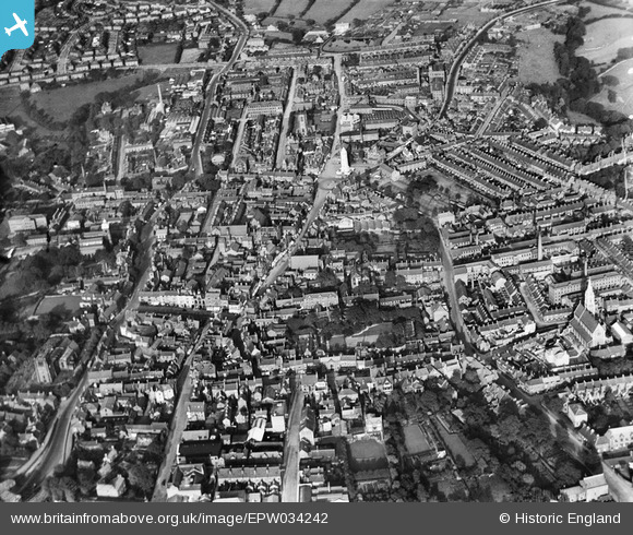
EPW034242 ENGLAND (1930). The town centre, Leek, 1930
© Copyright OpenStreetMap contributors and licensed by the OpenStreetMap Foundation. 2024. Cartography is licensed as CC BY-SA.
Nearby Images (6)
EPW034242

EPW034246

EPW034241

EPW046320

EPW034243

EAW037605

Details
| Title | [EPW034242] The town centre, Leek, 1930 |
| Reference | EPW034242 |
| Date | July-1930 |
| Link | |
| Place name | LEEK |
| Parish | LEEK |
| District | |
| Country | ENGLAND |
| Easting / Northing | 398594, 356484 |
| Longitude / Latitude | -2.021003693343, 53.105251624003 |
| National Grid Reference | SJ986565 |
Pins
 Sara |
Thursday 9th of March 2023 03:06:46 PM | |
Sara |
Thursday 9th of March 2023 03:05:57 PM | |
Sara |
Thursday 9th of March 2023 03:03:47 PM | |
Sara |
Thursday 9th of March 2023 03:02:53 PM | |
Paul |
Sunday 17th of January 2021 01:41:42 AM | |
Paul |
Sunday 17th of January 2021 01:40:39 AM | |
Chrissy_R |
Saturday 31st of December 2016 05:16:36 AM |


