
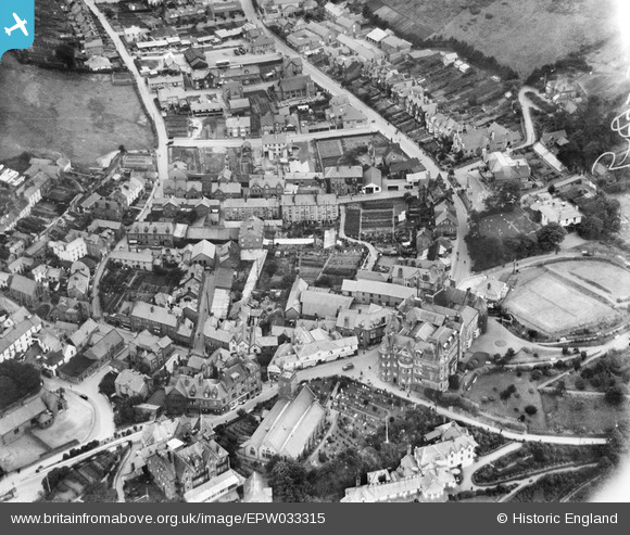
EPW033315 ENGLAND (1930). The town centre, Lynton, 1930
© Copyright OpenStreetMap contributors and licensed by the OpenStreetMap Foundation. 2024. Cartography is licensed as CC BY-SA.
Nearby Images (7)
EPW033315

EPW033313

EPW033312

EPW039940

EPW033314

EPW039941

EPW039942

Details
| Title | [EPW033315] The town centre, Lynton, 1930 |
| Reference | EPW033315 |
| Date | July-1930 |
| Link | |
| Place name | LYNTON |
| Parish | LYNTON AND LYNMOUTH |
| District | |
| Country | ENGLAND |
| Easting / Northing | 271930, 149423 |
| Longitude / Latitude | -3.8344399718759, 51.22909251087 |
| National Grid Reference | SS719494 |
Pins
Be the first to add a comment to this image!


