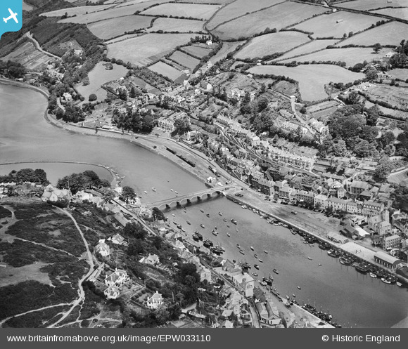
EPW033110 ENGLAND (1930). The bridge between East and West Looe and environs, East Looe, 1930
© Copyright OpenStreetMap contributors and licensed by the OpenStreetMap Foundation. 2024. Cartography is licensed as CC BY-SA.
Nearby Images (5)
EPW033110

EPW033111

EAW051359

EPW033056

EAW020277

Details
| Title | [EPW033110] The bridge between East and West Looe and environs, East Looe, 1930 |
| Reference | EPW033110 |
| Date | July-1930 |
| Link | |
| Place name | EAST LOOE |
| Parish | LOOE |
| District | |
| Country | ENGLAND |
| Easting / Northing | 225454, 53657 |
| Longitude / Latitude | -4.4540670025116, 50.35629549278 |
| National Grid Reference | SX255537 |