
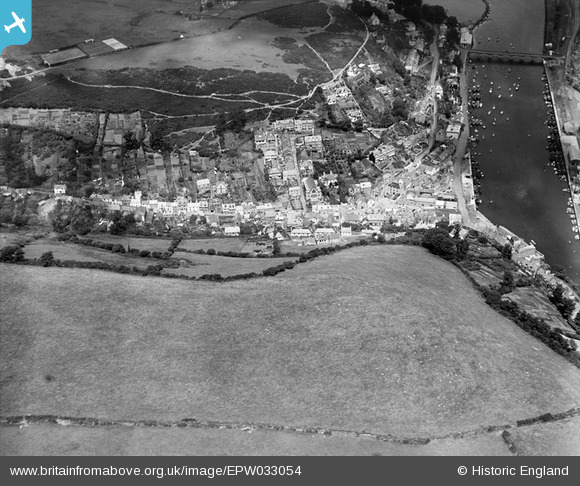
EPW033054 ENGLAND (1930). West Looe Hill and the harbour, West Looe, 1930
© Copyright OpenStreetMap contributors and licensed by the OpenStreetMap Foundation. 2024. Cartography is licensed as CC BY-SA.
Nearby Images (6)
EPW033054

EPW033053

EAW020276

EAW051356

EAW051357

EPW033108

Details
| Title | [EPW033054] West Looe Hill and the harbour, West Looe, 1930 |
| Reference | EPW033054 |
| Date | July-1930 |
| Link | |
| Place name | WEST LOOE |
| Parish | LOOE |
| District | |
| Country | ENGLAND |
| Easting / Northing | 225239, 53155 |
| Longitude / Latitude | -4.4568539353476, 50.351720723612 |
| National Grid Reference | SX252532 |
Pins
Be the first to add a comment to this image!


