
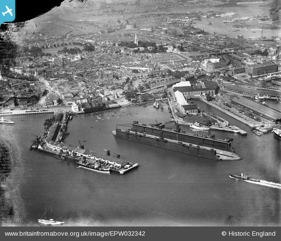
EPW032342 ENGLAND (1930). The Floating Dock, the Town Quay and Trafalgar Dry Dock, Southampton, 1930
© Copyright OpenStreetMap contributors and licensed by the OpenStreetMap Foundation. 2024. Cartography is licensed as CC BY-SA.
Nearby Images (25)
EPW032342

EAW020647
 Marine Airport and the surrounding docks, Southampton, 1948")
EAW020645
 Marine Airport and the surrounding docks, Southampton, 1948")
EAW008802

EPW041065

EAW001347

EAW189228

EAW020646
 Marine Airport and the surrounding docks, Southampton, 1948")
EPW041066

EPW041064

EAW001358

EAW008812

EAW008798

EAW008796

EAW008791

EPW020452

EAW008795

EAW001375

EPW041073

EPW037430

EAW008801

EAW008803

EPW041067

EPW020455

EAW015267

Details
| Title | [EPW032342] The Floating Dock, the Town Quay and Trafalgar Dry Dock, Southampton, 1930 |
| Reference | EPW032342 |
| Date | June-1930 |
| Link | |
| Place name | SOUTHAMPTON |
| Parish | |
| District | |
| Country | ENGLAND |
| Easting / Northing | 442053, 110785 |
| Longitude / Latitude | -1.4019908557308, 50.894459854836 |
| National Grid Reference | SU421108 |
Pins
Be the first to add a comment to this image!


