
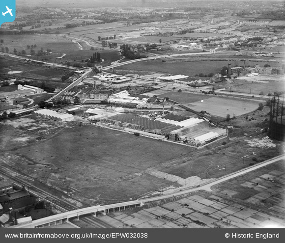
EPW032038 ENGLAND (1930). The Gothic Gas Meters and Stove Works and environs, Edmonton, 1930
© Copyright OpenStreetMap contributors and licensed by the OpenStreetMap Foundation. 2024. Cartography is licensed as CC BY-SA.
Nearby Images (37)
EPW032038

EPW032042

EPW044759

EPW044760

EPW032759

EPW032762

EPW032043

EPW032039

EPW044758

EPW032763

EPW032757

EPW032761

EPW044755

EPW056394

EPW044757

EPW032758

EPW044750

EPW032760

EPW044761

EPW032037

EPW032764

EPW044751

EPW044749

EPW044752

EPW044756

EPW032044

EPW044753

EPW048901

EPW032036

EPW044754

EPW042084

EPW042083

EPW048900

EPW049728
 and other factories, Edmonton, 1936")
EPW042088

EPW049530

EPW042087

Details
| Title | [EPW032038] The Gothic Gas Meters and Stove Works and environs, Edmonton, 1930 |
| Reference | EPW032038 |
| Date | May-1930 |
| Link | |
| Place name | EDMONTON |
| Parish | |
| District | |
| Country | ENGLAND |
| Easting / Northing | 535441, 191887 |
| Longitude / Latitude | -0.043813722501399, 51.609032822651 |
| National Grid Reference | TQ354919 |
Pins
 Ray Flack |
Wednesday 5th of November 2014 12:38:38 PM |


