
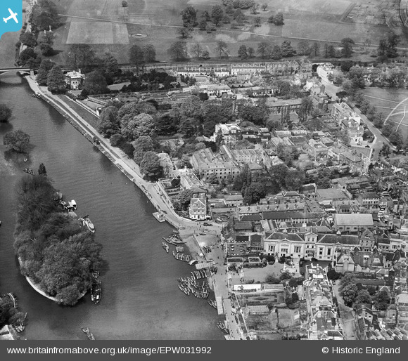
EPW031992 ENGLAND (1930). Lissen Ltd Works on Friar's Lane and The Riverside, Richmond, 1930
© Copyright OpenStreetMap contributors and licensed by the OpenStreetMap Foundation. 2024. Cartography is licensed as CC BY-SA.
Nearby Images (18)
EPW031992

EPW031988

EPW031987

EPW031990

EPW031989

EPW031991

EAW014151

EAW014152

EPW022842

EAW014149

EAW014150

EPW056173

EAW008242

EPW044552

EPW022837

EAW042759

EPW022844

EAW042758

Details
| Title | [EPW031992] Lissen Ltd Works on Friar's Lane and The Riverside, Richmond, 1930 |
| Reference | EPW031992 |
| Date | May-1930 |
| Link | |
| Place name | RICHMOND |
| Parish | |
| District | |
| Country | ENGLAND |
| Easting / Northing | 517592, 174733 |
| Longitude / Latitude | -0.30720807284201, 51.458855601887 |
| National Grid Reference | TQ176747 |
Pins
Be the first to add a comment to this image!


