
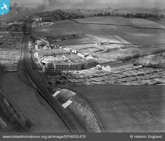
EPW031478 ENGLAND (1930). The Vauxhall Motor Car Works, Luton, 1930
© Copyright OpenStreetMap contributors and licensed by the OpenStreetMap Foundation. 2024. Cartography is licensed as CC BY-SA.
Nearby Images (45)
EPW031478

EPW031484

EPW040903

EPW031473

EPW031481

EPW031486

EAW050186B

EPW031479

EPW031477

EPW031476

EAW050179

EPW019222

EPW022399

EPW048408

EPW040904

EPW040911

EPW031487

EPW040908

EPW046837

EPW031474

EPW019223

EPW022403

EPW031475

EPW046838

EPW046592

EPW040906

EPW046835

EPW046589

EPW048406

EPW048407

EAW050186

EPW046836

EPW040909

EPW046588

EAW000079

EPW046586

EPR000043

EPW046593

EPR000042

EPR000041

EPR000044

EPR000045

EPW048414

EPW048415

EAW000080

Details
| Title | [EPW031478] The Vauxhall Motor Car Works, Luton, 1930 |
| Reference | EPW031478 |
| Date | February-1930 |
| Link | |
| Place name | LUTON |
| Parish | |
| District | |
| Country | ENGLAND |
| Easting / Northing | 510744, 220538 |
| Longitude / Latitude | -0.39122497863479, 51.871966132028 |
| National Grid Reference | TL107205 |
Pins
Be the first to add a comment to this image!


