
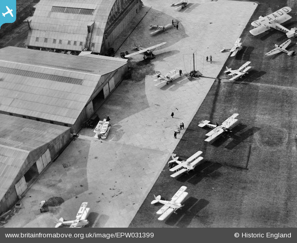
EPW031399 ENGLAND (1930). Heston Air Park with biplanes on the airfield including the Gloster Survey (G-AADO), Heston, 1930
© Copyright OpenStreetMap contributors and licensed by the OpenStreetMap Foundation. 2024. Cartography is licensed as CC BY-SA.
Nearby Images (48)
EPW037585

EPW038203

EPW040092

EPW040094

EPW031393

EPW034842
 after completing her world solo flight, 1931")
EPW037586

EPW037522

EPW038207

EPW036078

EPW028591

EPW028210

EPW044693

EPW040090

EPW037933

EPW040089

EPW031395

EPW038201

EPW033771

EPW037989

EPW061093

EPW053980

EPW028592

EPW031394

EPW044699

EPW037938

EPW033767

EPW038205

EPW037936

EPW037338

EPW037937

EPW037902

EPW036080

EPW028213

EPW038204

EPW060377

EPW037901

EPW036120

EPW060375

EPW037941

EPW031397

EPW034901

EPW031396

EPW037939

EPW037940

EPW037993

EPW025552

EPW037992

Details
| Title | [EPW031399] Heston Air Park with biplanes on the airfield including the Gloster Survey (G-AADO), Heston, 1930 |
| Reference | EPW031399 |
| Date | February-1930 |
| Link | |
| Place name | HESTON |
| Parish | |
| District | |
| Country | ENGLAND |
| Easting / Northing | 511432, 177661 |
| Longitude / Latitude | -0.39492213645043, 51.486421866129 |
| National Grid Reference | TQ114777 |
Pins
Be the first to add a comment to this image!


