
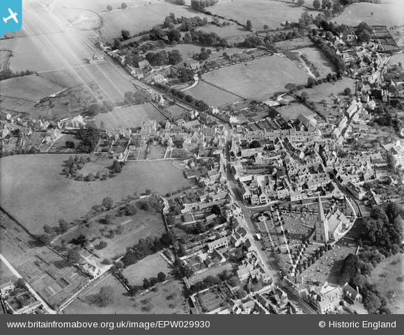
EPW029930 ENGLAND (1929). St Mary's Church and the town, Painswick, 1929
© Copyright OpenStreetMap contributors and licensed by the OpenStreetMap Foundation. 2024. Cartography is licensed as CC BY-SA.
Nearby Images (11)
EPW029930

EPW029932

EPW023899

EPW029933

EPW023901

EPW029936

EPW023898

EPW023905

EPW023900

EPW029931

EPW029934

Details
| Title | [EPW029930] St Mary's Church and the town, Painswick, 1929 |
| Reference | EPW029930 |
| Date | September-1929 |
| Link | |
| Place name | PAINSWICK |
| Parish | PAINSWICK |
| District | |
| Country | ENGLAND |
| Easting / Northing | 386707, 209816 |
| Longitude / Latitude | -2.1927355340363, 51.786394639963 |
| National Grid Reference | SO867098 |
Pins
Be the first to add a comment to this image!


