
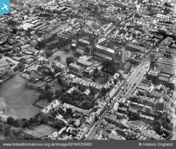
EPW029880 ENGLAND (1929). The Cathedral Church of Christ and the Blessed Virgin Mary and environs, Chester, 1929
© Copyright OpenStreetMap contributors and licensed by the OpenStreetMap Foundation. 2024. Cartography is licensed as CC BY-SA.
Nearby Images (21)
EPW029880

EPW011199

EPW004007

EPW005885

EPW004003

EPW004008

EAW004377

EPW040162

EPW029886

EPW058007

EPW004006

EPW029883

EPW011200

EPW058010

EPW003090

EPW029885

EPW058002

EPW003097

EPW040167

EAW013771

EPW029881

Details
| Title | [EPW029880] The Cathedral Church of Christ and the Blessed Virgin Mary and environs, Chester, 1929 |
| Reference | EPW029880 |
| Date | September-1929 |
| Link | |
| Place name | CHESTER |
| Parish | |
| District | |
| Country | ENGLAND |
| Easting / Northing | 340543, 366530 |
| Longitude / Latitude | -2.890012085125, 53.192242919793 |
| National Grid Reference | SJ405665 |
Pins
Be the first to add a comment to this image!


