
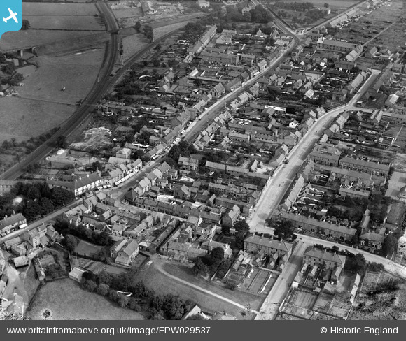
EPW029537 ENGLAND (1929). Commercial Street and environs, Norton-on-Derwent, 1929
© Copyright OpenStreetMap contributors and licensed by the OpenStreetMap Foundation. 2024. Cartography is licensed as CC BY-SA.
Nearby Images (3)
EPW029537

EPW048545

EPW029535

Details
| Title | [EPW029537] Commercial Street and environs, Norton-on-Derwent, 1929 |
| Reference | EPW029537 |
| Date | September-1929 |
| Link | |
| Place name | NORTON-ON-DERWENT |
| Parish | NORTON-ON-DERWENT |
| District | |
| Country | ENGLAND |
| Easting / Northing | 479413, 471362 |
| Longitude / Latitude | -0.78451642483894, 54.131787890842 |
| National Grid Reference | SE794714 |
Pins
Be the first to add a comment to this image!


