
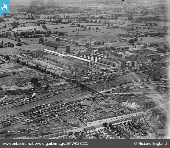
EPW028221 ENGLAND (1929). British Thomson-Houston Electrical Engineering Works, Rugby, 1929
© Copyright OpenStreetMap contributors and licensed by the OpenStreetMap Foundation. 2024. Cartography is licensed as CC BY-SA.
Nearby Images (32)
EPW028221

EPW028216

EPW028852

EPW028217

EPW028214

EPW028222

EAW000239

EAW001117

EAW000240

EAW000244

EPW033934

EPW001337

EPW028855

EPW033931

EAW001112

EPW010529

EPW033932

EPW028220

EAW001114

EPW028215

EPW033938

EAW001115

EPW033937

EPW028218

EAW001113

EAW000245

EAW001118

EAW001116

EAW000247

EPW028849

EPW028219

EAW000243

Details
| Title | [EPW028221] British Thomson-Houston Electrical Engineering Works, Rugby, 1929 |
| Reference | EPW028221 |
| Date | July-1929 |
| Link | |
| Place name | RUGBY |
| Parish | |
| District | |
| Country | ENGLAND |
| Easting / Northing | 450706, 276195 |
| Longitude / Latitude | -1.2549708376313, 52.381058827314 |
| National Grid Reference | SP507762 |
Pins
Be the first to add a comment to this image!


