
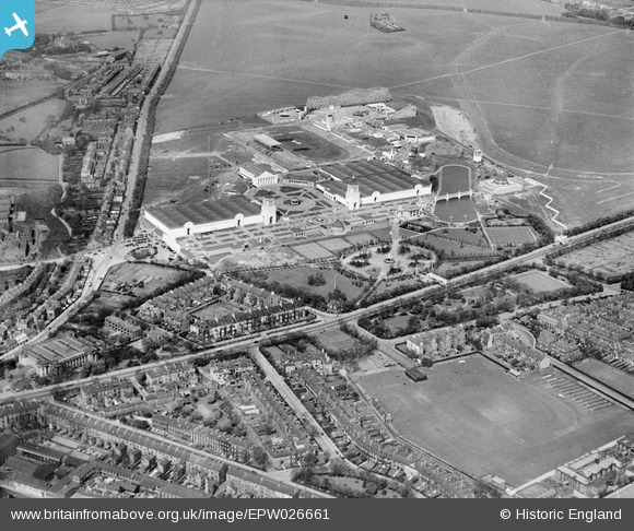
EPW026661 ENGLAND (1929). The North East Coast Exhibition, Newcastle upon Tyne, from the south-east, 1929
© Copyright OpenStreetMap contributors and licensed by the OpenStreetMap Foundation. 2024. Cartography is licensed as CC BY-SA.
Nearby Images (10)
EPW026661

EPW026663

EPW026668

EPW025033

EPW025036

EPW026664

EPW019807

EPW026658

EPW026665

EPW026666

Details
| Title | [EPW026661] The North East Coast Exhibition, Newcastle upon Tyne, from the south-east, 1929 |
| Reference | EPW026661 |
| Date | May-1929 |
| Link | |
| Place name | NEWCASTLE UPON TYNE |
| Parish | |
| District | |
| Country | ENGLAND |
| Easting / Northing | 424972, 565391 |
| Longitude / Latitude | -1.6097523967592, 54.982418608376 |
| National Grid Reference | NZ250654 |
Pins
 Maz |
Wednesday 24th of January 2018 08:47:01 PM | |
Maz |
Wednesday 24th of January 2018 08:39:27 PM |


